Arashiyama and Saga: from Togetsukyo Bridge to Daikakuji
In Arashiyama the Kyoto City Tourism Association streams two cams: the north end of Togetsukyo Bridge and the Bamboo Grove path. The bridge cam shows the bridge with the slopes of Mt Arashiyama behind it, so you see the colour on the hillside and the crowd on the bridge at once.
A little further north in Saga there are cams at Daikakuji, Seiryoji (Saga Shaka-do) and the old Saga-Toriimoto street, all from the same association. Kyoto City's autumn leaves report (紅葉だより) gives the typical peak for Arashiyama, Daikakuji, Tenryuji and Jojakkoji as mid to late November.
Higashiyama: the Philosopher's Path, Ginkaku-ji and Kiyomizu-dera
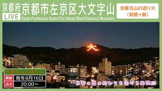
On the north side of Higashiyama, the Philosopher's Path (Kyoto City Tourism Association), Ginkaku-ji (京都観光混雑状況Live) and Mt Daimonji cams are close together. Typical peaks in the city's report: the Philosopher's Path mid November to early December; Ginkaku-ji, Honen-in, Eikando and Nanzenji mid to late November.
To the south there is a distant view of Kiyomizu-dera and the Yasaka Pagoda, a cam on Kiyomizu-zaka (京都観光混雑状況Live) and one on Nene-no-michi beside Kodaiji (Kyoto City Tourism Association). Use the distant view for the colour on the hills and the street cams for the crowds. Kiyomizu-dera and Kodaiji typically peak in mid to late November.
Central Kyoto: Kitano Tenmangu, Kyoto Gyoen and Chishaku-in
The cam in front of Kitano Tenmangu (Kyoto City Tourism Association) and the Kyoto Shimbun cam looking from Karasuma Nijo toward Kyoto Gyoen are near the city-centre leaf spots. The report gives Kitano Tenmangu and Kyoto Gyoen a typical peak from mid November to early December, a little later than Higashiyama and Arashiyama.
Chishaku-in in Higashiyama-Shichijo streams its scenic garden on the temple's own sub-channel. It keeps the same angle all season, so you can follow the garden's trees as they change colour.
Northern hills: Kifune Shrine and Kiyotaki
Kifune Shrine, up in the hills, can be watched on the 京都観光混雑状況Live cam on its approach. Its typical peak is mid November, a little earlier than the city centre.
Deep in Saga, a cam at the Kinrei Bridge over the Kiyotaki River is streamed by a local shop, 京都清滝さくらや. The valley trees fill the frame, so you see mountain leaves rather than city ones.
How to check the peak, and official information
Kyoto City's official travel site has an autumn leaves page; the spot-by-spot typical peaks and the status during the season are in the city's Japanese report, 紅葉だより. Look up the rough timing first, then open the nearest live cam to see the colour and the crowd right now.
Colours are easiest to judge in daylight; some cams go dark or show little at night. Kyoto is 1 hour ahead of Hong Kong, Taipei and Singapore, and the same time as Seoul. Live cams of autumn leaves outside Kyoto are on our Japan autumn leaves page.
FAQ
When do the autumn leaves peak in Kyoto?
Kyoto City's official report (紅葉だより) gives typical peaks of mid to late November for most spots, including Arashiyama, Ginkaku-ji, Kiyomizu-dera and Tofukuji; mid November to early December for the Philosopher's Path, Kitano Tenmangu and Kyoto Gyoen; and mid November for Kifune Shrine. It shifts from year to year, so check the report and the live cams during the season.
Where can I watch Kyoto's autumn leaves live?
This page covers 16 cams: Togetsukyo Bridge, the Bamboo Grove, Daikakuji, Seiryoji and Saga-Toriimoto; the Philosopher's Path, Ginkaku-ji, Mt Daimonji, the Higashiyama view of Kiyomizu-dera and the Yasaka Pagoda, Kiyomizu-zaka and Nene-no-michi; Kitano Tenmangu, Karasuma Nijo toward Kyoto Gyoen and the Chishaku-in garden; Kifune Shrine and the Kiyotaki River. All are YouTube live streams you can play on this page.
Can I see how crowded it is?
The Kiyomizu-zaka, Ginkaku-ji and Kifune Shrine cams are run by 京都観光混雑状況Live and show the people on the approaches. The Togetsukyo Bridge and Nene-no-michi cams also give a sense of the crowd.